AKBOT-180
AKBOT-180
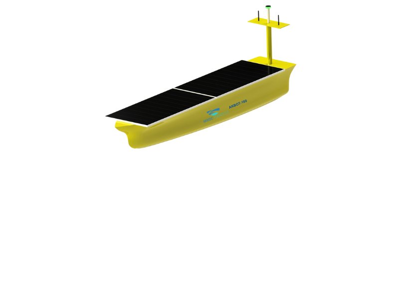
AKBOT-180 reduces labor and operational costs in bathymetric studies. The AKBOAT-180 has a minimum draft of 20 cm, enabling it to operate in shallow waters where large ships cannot enter. The route is easily created from the interface software, and it can navigate autonomously on the determined route with +/- 1.5 cm accuracy with RTK GPS, Image Processing and Lidar.

AKBOT-180 reduces labor and operational costs in bathymetric studies. The AKBOAT-180 has a minimum draft of 20 cm, enabling it to operate in shallow waters where large ships cannot enter. The route is easily created from the interface software, and it can navigate autonomously on the determined route with +/- 1.5 cm accuracy with RTK GPS, Image Processing and Lidar.
It can transfer real-time data and images. The data saved in the interface program is easily transferred to the online portal and shared with the end users who want to be shared with one click. High course accuracy and full access to shallow water provide great convenience and benefit for research mission. As a new and efficient tool, the applications of USV in hydrographic surveys have been widely accepted.